Primary researcher(s): Prof. Elizabeth Capaldi, Janine Glathar, Lucas Hower, Sophia Martinez
Date: Ongoing
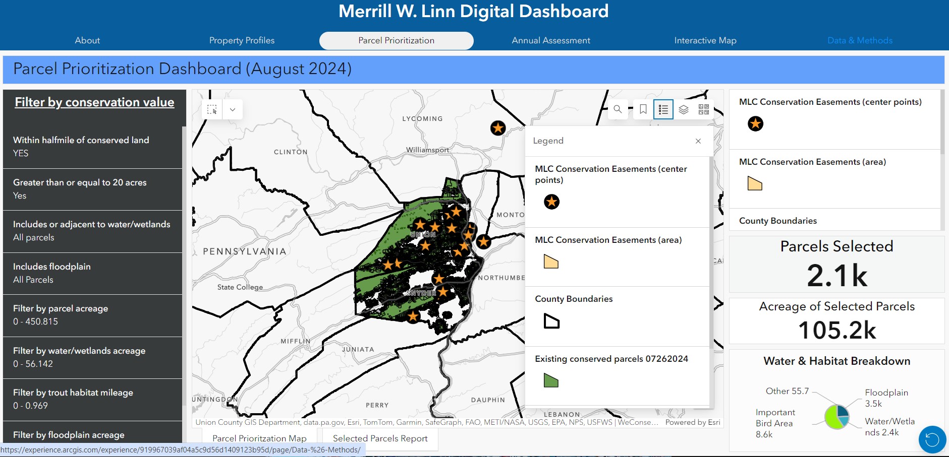
Prof. Elizabeth Capaldi (Biology) worked with Janine Glathar (GIS Specialist, DP&S) and two research students Abbey Jacobey , Lucas Hower (Penn State, Geography/GIScience ’26) and Sophia Martinez ’26 (Environmental Studies/Studio Art) on creating map layers, interactive maps, dashboards, data collection tools and a website for staff and stewards from the Merrill W. Linn Conservancy to use in prioritizing areas for conservation and managing existing easements. The project was launched in spring 2024 with Prof. Capaldi and her research student Abbey identifying map layers and creating maps to catalog Linn Conservancy’s easement holdings. Janine Glathar was brought into the project to help architect a solution for creating, storing, managing and updating GIS data related to the Linn Conservancy’s work on land conservation and preservation, leading to a summer research project funded through the DP&S SRP funding of stipends for Lucas Hower and Sophia Martinez. Over the course of the summer the team consulted with a variety of external partners (Union County Planning Department, Union County GIS Department, Chesapeake Conservancy) and with Linn Conservancy staff and site stewards to learn more about conservation planning, easement management and assessment and criteria considered when targeting areas for conservation. These conversations informed the development of a suite of tools that include a digital assessment survey, a parcel prioritization app & reporting tool, a property profiles showcase and an interactive mapping tool for Linn Conservancy to use in managing existing holdings and prioritizing locations for new easements.